by Richard Davies, FloodList
The overflowing Seine river in Paris and Île-de-France region caused around 1,000 people to evacuate their homes during late January 2018. Météo-France reported that the country had seen exceptional rainfall during January 2018, with some areas recording 4 to 5 times more rain than normal.
A storm brought further heavy rain between 20 and 21 January. This, combined with snowmelt in some areas caused river levels to increase.
In the department of Doubs the Loue River, a tributary of the Doubs, burst its banks flooding parts of the town of Ornans. The river reached 2.58 metres, the second highest level recorded after the 1953 high of 3.2m. Upstream, melting snow and heavy rain had caused the Doubs river to overflow in St-Ursanne in Jura, Switzerland.
Issued alerts and notifications
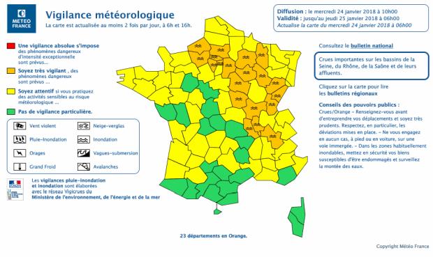
By 24 January, Météo-France had issued flood alerts for at least 20 departments of the country, including the Paris region.
In what seemed like a possible repeat of the flooding of summer 2016, the rising river Seine in Paris and the Île-de-France region caught the attention of the world's media. Thousands of homes were flooded and four people died in flood-related incidents during the floods of May to June 2016. The Association Française de l’assurance (AFA) estimated the cost of the 2016 floods to be as high as €1.4 billion.
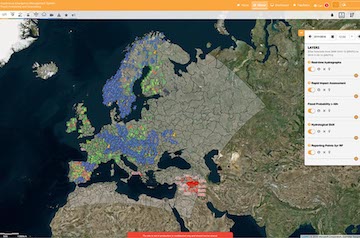
EFAS predicted the event well in advance with lead times ranging from 4-8 days (Table 1). 13 flood notifications and a large number of flash flood notifications were sent for the event.
The development of the event
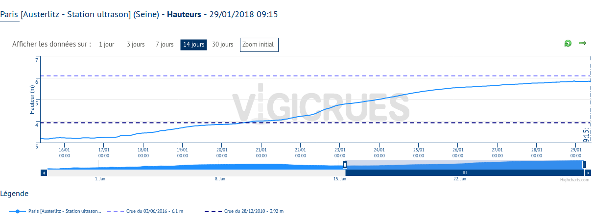
As of midday 24 January 2018, the Seine at Austerlitz Bridge in Paris stood at 5.22 metres. In a bulletin of 24 January, Vigicrues said that a maximum level of up to 6.2 metres was possible during the weekend 26 to 28 January. At the peak of the 2016 floods, the Seine at Austerlitz Bridge reached 6.10 metres. Paris authorities suspended river traffic, closed several roads along the river and central stations of city’s RER C train line. A lower level of the Louvre Museum was closed.
Levels of the river crept higher over the next few days affecting an area stretching from east of Paris along the Marne river, a tributary of the Seine, through Paris and northwards along the Seine. Police in Paris said on 27 January that around 1,000 people had evacuated their homes including 358 in Val de Marne, 214 in Essonne, 154 in Seine et Marne and 105 in Yvelines. Some patients were evacuated from medical establishments, including 94 in Villeneuve-Saint-Georges and 78 in Meulan Les Mureaux.
By early Monday, 29 January 2018 levels of the Seine peaked at around 5.85 to 5.88 metres (with a slight discrepancy between ultrasound (5.85m) and other measurements).